UAV Hire
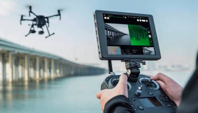
DJI M600 + Payloads
The Matrice 600 (M600) is DJI’s new flying platform designed for professional aerial photography and industrial applications. It is built to closely integrate with a host of powerful DJI technologies, including the A3 flight controller, Lightbridge 2 transmission system, Intelligent Batteries and Battery Management system, for maximum performance and quick setup.
- The M600 features an extended flight time and a 5 km* long-range
- DJI Lightbridge 2 for professional broadcasting
- The M600 is fully compatible with the DJI Onboard SDK
- I PAD hire optional
- 3 sets of batteries (18 total)
- 42MP Canon Camera for hire

DJI M210 RTK & M350RTK
The ultimate platform for aerial productivity combines a rugged design and simple configurability to work as a solution for a variety of industrial applications. Improvements to the M200 Series V2 enhance intelligent control systems, flight performance, and add flight safety and data security features.
- Anti-collision Beacon
- Discreet Mode
- Mobile SDK Compatibility
- DJI SkyPort Compatibility
- TimeSync
- 8 batteries for hire
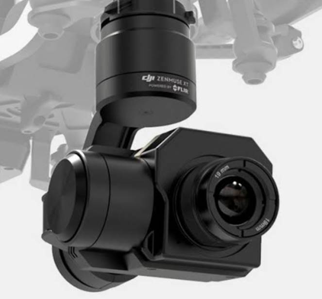
Zenmuse XT FLIR Camera
Thermal imaging from the air has never been as easy as it is with the DJI Zenmuse XT. By combining DJI’s unrivaled expertise in gimbal technology and image transmission with the industry leading thermal imaging technology of FLIR, the Zenmuse XT is the ultimate solution for rapid and reliable aerial thermal imaging. Capture faster, with pinpoint precision, over large areas, then save them for analysis and reporting.
- POWER LINE INSPECTION
- SOLAR PANEL INSPECTION
- SEARCH AND RESCUE
- PRECISION AGRICULTURE
- FIRE FIGHTING
- OIL & GAS PLANTS
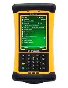
Trimble DGPS - Ground Control
The Trimble outdoor rugged handheld computer makes it easy to collect, save and transmit data with its many built-in capabilities. You pick the features to suit your needs. Compute your location with the integrated GPS receiver for navigation applications. Quickly track your assets with the integrated laser bar code scanner. Capture 5 megapixel color images with the integrated digital camera.
- Collect ground control points for ortho mapping
- Asset capture
- GPS tracking & GIS entry tool
.jpg)
DJI M600 Lidar solution
Sensor is a Velodyne vlp-16. Geodetics control unit, GPS and IMU. Custom built by PrecisionHawk USA.
Fast and accurate data collection, Corridor mapping with true 180° field of View.Digital Terrain models below Trees and Forest.Faster and flexible turnaround of airborne LiDAR for project applications
CALL US Today 0800 752 705
Reserve your rental equipment today!